Introduction
The aim of this wiki is to provide a resource for volcanologists who are interested in using satellite datasets to monitor volcanic activity, and to answer questions such as: what satellite datasets are useful for routine volcano surveillance? What measurements do they provide? What types of activity can be monitored?
An increasing number of satellite datasets are becoming available at no cost over the internet, representing a useful and cost-effective means of monitoring volcanoes (e.g., fluxes of heat and gases), particularly in remote regions. Satellite data are typically provided in a variety of formats and data processing levels that can be confusing to the uninitiated. In due course this wiki will be updated with the information needed to exploit the available satellite datasets relevant to volcanology. Other VHub users can also edit the wiki page and add relevant information.
The collection of links below will take you to external websites for various satellite sensor data products, mostly focused on monitoring of volcanic clouds and plumes. To see a list of acronyms and abbreviations, check the Glossary.
Observations of volcanic activity
The following links will direct you to already processed satellite data showing thermal anomalies, tephra dispersion, gas emissions and/or flow emplacement.
- Earth Observatory (NASA), Natural Hazards: This site provides high resolution images of recent eruptive activity acquired by MODIS and the Advanced Land Imager (ALI). http://earthobservatory.nasa.gov/NaturalHazards/
- MODIS Thermal IR hotspots (MODVOLC – Univ Hawaii): http://modis.higp.hawaii.edu/
- Operational SO2 data from OMI (NASA GSFC): http://so2.gsfc.nasa.gov
Near real-time volcanic data
The datasets listed below are typically available with minimum data latency, and can therefore provide timely observations during volcanic eruptions.
Sulfur dioxide (SO2) and aerosols
OMI (UV) from NOAA: http://satepsanone.nesdis.noaa.gov/pub/OMI/OMISO2/index.html
OMI (UV) Very Fast Delivery (VFD) volcanic products from the Finnish Meteorological Institute (FMI): http://omivfd.fmi.fi/volcanic.html (available within 15 minutes of the OMI overpass for the North Atlantic)
GOME-2 (UV) from NOAA: http://satepsanone.nesdis.noaa.gov/pub/GOME/GOMESO2/index.html
OMI, GOME-2 and SCIAMACHY (UV) from BIRA/IASB: http://sacs.aeronomie.be/nrt/
GOME-2 (UV) from DLR: http://wdc.dlr.de/data_products/SERVICES/GOME2NRT/so2.php?
IASI (IR) from ULB: http://cpm-ws4.ulb.ac.be/Alerts/index.php
AIRS (IR) from NOAA: http://www.star.nesdis.noaa.gov/smcd/spb/iosspdt/iosspdt.php?so2=1
High-resolution Absorbing Aerosol Index (AAI) from GOME-2: http://www.temis.nl/o3msaf/vaac_pmd/
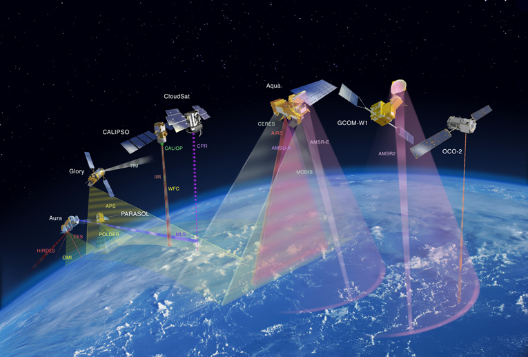
A-Train data
(The A-Train is a constellation of satellites flying in close formation, providing near-coincident data from multiple sensors)
MODIS Rapid Response (NASA GSFC): http://rapidfire.sci.gsfc.nasa.gov/realtime/
CALIPSO lidar expedited browse images: http://www-calipso.larc.nasa.gov/products/lidar/browse_images/expedited/
CloudSat Quicklook images (Colorado State): http://www.cloudsat.cira.colostate.edu/dpcstatusQL.php
MODIS Direct Broadcast products from Sodankylä (Finland): http://litdb.fmi.fi/direct_broadcast/db_archive.php
Other useful sites
Geostationary satellite image browser (SSEC – Univ Wisconsin Madison): http://www.ssec.wisc.edu/data/geo/
GOES East and West (NOAA/Colorado State Univ): http://rammb.cira.colostate.edu/ramsdis/online/goes-west_goes-east.asp
Alaska Volcano Observatory (AVO) Image Flipper (AVHRR, MODIS, GOES, and MTSAT for the North Pacific): http://avo.images.alaska.edu/tools/ftp_browser.php
Latest volcanic ash advisories from all VAACs: http://www.bom.gov.au/products/Volc_ash_recent.shtml
Washington VAAC: http://www.ssd.noaa.gov/VAAC/
Real-time NEXRAD weather radar (USA only): http://www.rap.ucar.edu/weather/radar/
Global radiosonde soundings (Univ Wyoming): http://weather.uwyo.edu/upperair/sounding.html
NASA Goddard Modeling and Assimilation Office (GMAO) Wx Forecasts: http://portal.nccs.nasa.gov/cgi-yotc/fp_wx.cgi
Smithsonian Institution Global Volcanism Program and USGS weekly volcanic activity report: http://www.volcano.si.edu/reports/usgs/