PASI: Volcanic Hazards and Remote Sensing in Pacific Latin America
Category
Published on
Abstract
http://www.geo.mtu.edu/~raman/PASI2011
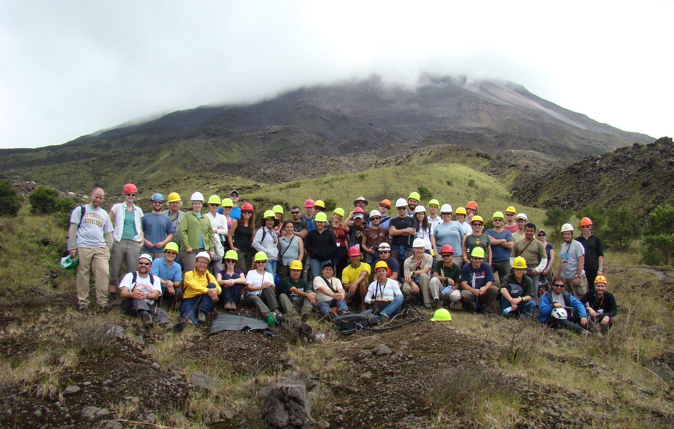
The Open Vent Volcanoes PASI in Costa Rica gathered 60 scientists from 13 countries to build scientific networking in the transdisciplinary field of volcanology in January 2011. The accelerating application of field measurements and remote sensing to geological hazards is facilitated by collaborations in earth's most hazardous regions; Pacific Latin America is subject to frequent eruptions, landslides, earthquakes and hurricanes and is near the US science community, but is nonetheless sparsely investigated. We aim to stimulate this kind of international effort by gathering the critical US science and Pacific Latin American counterpart groups.
This proposal funded participants from the US and from the Americas, to attend a workshop hosted at the University of Costa Rica for two weeks of lectures, computer laboratory and field experiences aimed at Remote Sensing for Mitigation of Natural Hazards in Latin America. We expect to use the event to further develop human and social science aspects of hazards research which have begun to emerge. In addition to developing special publications and web outreach of workshop products, we expect this event to 1) increase the number of scientists working on hazards research in universities, government agencies and non-governmental organizations in both the US and the Americas, and 2) foster communication among these institutions, and 3) build stronger collaborative relationships as a result of this workshop.
While the planned workshop includes fundamental aspects of remote sensing and digital image processing, the topics are presented in the context of new developments for studying volcanic processes and hazards. Goals of the workshop included: 1) increasing awareness of available data and instruments for collecting data, 2) increasing proficiency in acquiring and processing data, 3) increasing awareness of the availability of tools for processing remotely sensed data, and 4) enabling more effective and comprehensive archiving and sharing of data. The workshop curricula were designed in a manner to best serve the participants, while understanding the broad range of participants' technical background and institutional support, as well as equipment and funding at their disposal.
Presentations
Monday, January 10: Volcanic ash sensing and volcanic threat assessment
Workshop welcome and intro to volcanic ashfall hazards and sensing by Bill Rose .pdf .mov
Recent developments in volcanic ash remote sensing by Fred Prata .pdf .mov (example) .mov (presentation)
Assessing the Volcanic Threat in Latin America by Jose Luis Palma .pdf
Hazard, Threat, Vulnerability and Risk by Hugo Delgado Granados .pdf
Volcanoes in Costa Rica by Guillermo Alvarado .pdf
Tuesday, January 11: OMI and other volcanic SO2 sensing techniques
OMI and other volcanic SO2 sensing: Introduction by Simon Carn .pdf
Ground-based SO2 measurement techniques: Theory by Jose Luis Palma .pdf
Techniques to measure SO2 volcanic plumes and geometrical consideration by Lizzette Rodriguez .pdf
Chemistry of SO2 in tropospheric volcanic plumes by Lizzette Rodriguez .pdf
Wednesday, January 12: InSAR Deformation Mapping and Modeling
Part I: basics of synthetic aperture radar (SAR) imaging by Zhong Lu .pdf
Part II: interferometric SAR (InSAR) processing by Zhong Lu .pdf
Part III: InSAR deformation modeling by Zhong Lu .pdf
Part IV: InSAR application, SAR data availability, and InSAR processing software by Zhong Lu .pdf
Thursday, January 13: El papel de los volcanologos en el manejo de las crisis volcanicas (in Spanish)
La percepcion del riesgo y su definicion by Rudiger Escobar Wolf .pdf
Teoria sobre sistemas de alerta temprana by Rudiger Escobar Wolf .pdf
El problema del riesgo en el volcan Galeras by Milton Ordonez .pdf
El desarrollo de la crisis en el volcan Santa Ana, El Salvador, en el ano 2005 by Dolors Ferres .pdf
El volcan Tungurahua: 12 anos de actividad eruptiva by Jorge Bustillos .pdf
Los esfuerzos actuales para la reduccion del riesgo volcanico en Nicaragua by Martha Navarro .pdf
El cambio de paradigma hacia las estrategias participativas para la reduccion del riesgo volcanico by Luke Bowman .pdf
Friday, January 14: Seismo-acoustic data applications
Overview of volcano seismology by Diana Roman .pdf
Overview lecture on volcano infrasound, instrumentation fundamentals, and
recorded signals by Jeff Johnson .pdf
Multiparameter investigations at Fuego and Santiaguito volcanoes by John Lyons .pdf
Integration of seismo-acoustic data by Nick Varley .pdf
The origin of volcanotectonic (VT) earthquake swarms by Diana Roman .pdf
Telica volcano, Nicaragua: Preliminary results of the TESAND experiment by Mel Rodgers .pdf
Low frequency volcanic seismicity by Greg Waite .pdf
Application of techniques and interpretation of data: Arenal, Turrialba and Poas volcano by Mauricio Mora .pdf
Seismological aspects of Cerro Machin volcano by Milton Ordonez .pdf
Saturday, January 15: UV camera, DOAS and FTIR
UV digital imaging of volcanic plumes by Tricia Nadeau .pdf
UV Ground-based imaging camera: EnviCam by Fred Prata .pdf
Fourier Transform Infrared (FTIR) spectroscopy at active volcanoes by Simon Carn .pdf
Thursday, January 20: GPS systems and precise measurements of deformation
GPS and volcano monitoring by Charles DeMets .pdf
Differential GPS on Volcan Santa Ana, El Salvador by Charles DeMets .pdf
Monitoreo de Deformacion en volcanes activos en el Peru by Edu Taipe .pdf
Deformation at Machin Volcano by Milton Ordonez .pdf
GPS studies at Concepcion Volcano by Jose A Saballos .pdf
Friday, January 21: Applications of IR cameras in volcanic regions
IR camera techniques for measuring atmospheric gases and particles by Fred Prata .pdf
Monitoring Kilauea s summit and east rift zone eruptions with thermal cameras by Matt Patrick .pdf
Monitoring of effusive eruptions: Bezymianny, Sheveluch and Mt. St. Helens volcanoes by Mike Ramsey .pdf
Thermal imagery of passive volcanic activity by Nick Varley .pdf
Theory and application of multispectral thermal imaging camera by Fred Prata .pdf
Strombolian dynamics from thermal (FLIR) video imagery by Matt Patrick .pdf
Thermal monitoring at Volcan de Colima, Mexico by Nick Varley .pdf
Fumaroles and mud pots by Mike Ramsey .pdf
Thermal monitoring of volcanoes in Ecuador by Vallejo .pdf
Fixed thermal cameras at active volcanoes by Matt Patrick .pdf
Saturday, January 22: Satellite-based thermal IR anomalies
Thermal remote sensing of active volcanoes by Rob Wright .pdf
ASTER and its application to volcanic hazard assessment by Mike Ramsey .pdf
Thermal remote sensing of active volcanoes in an operational environment: approaches of Alaska (AVO) and Hawaii (HVO) by Matt Patrick .pdf
Sunday, January 23: Vhub.org and Modeling volcanic hazards
Vhub.org: Cyberinfrastructure for collaborative volcano research and risk mitigation by Jose L. Palma .pdf
Introduction to modeling volcanic hazards by Jose L. Palma .pdf
Methodology for hazards map construction by Hugo Delgado G. .pdf
Modeling lava flows by Einat Lev .pdf
Numerical modeling of pyroclastic flows: a case study from the recent activity of Merapi volcano, Central Java, Indonesia. by Sylvain Charbonnier .pdf
Cite this work
Researchers should cite this work as follows: